Les Menuires → Chalet de la Masse

The exact pistes and lifts to ride from Les Menuires to Chalet de la Masse — computed leg by leg, spoken turn by turn.

Below is a real route Glidr computed over Les Menuires’s routing graph: 10 legs, 4.6 km on the pistes and 3.1 km on the lifts, from the village to Chalet de la Masse.

Les Menuires already gives you a good map — on the mountain, in the resort’s own app, and on its website, with live lift and piste status. What none of them do is plan the way there. Tell Glidr where you are and where you want to get to, and it works out the exact sequence of pistes and lifts to ride, then guides you turn by turn. Here is that sequence to Chalet de la Masse.

The computed route

7.8 kmTotal distance
4.6 kmOn pistes
3.1 kmOn lifts
1,026 mDescent (pistes)
~28 minEstimated time*
AdvancedDifficulty†
  1. Piste · Preyerand Head down Preyerand 155 m · level Easy
  2. Piste · Boulevard de la Masse Keep left onto Boulevard de la Masse 940 m · −71 m vertical Novice
  3. Lift · Pointe de la Masse Take Pointe de la Masse lift 3,140 m · +1,050 m ascent
  4. Piste · Masse U-turn onto Masse 724 m · −253 m vertical Advanced
  5. Piste · Fréderic Covili Bear right onto Fréderic Covili 327 m · −80 m vertical Intermediate
  6. Piste · Bouquetin Continue on Bouquetin 922 m · −162 m vertical Easy
  7. Piste · Vallons Keep right onto Vallons 43 m · −3 m vertical Easy
  8. Piste · Mur Rouge Continue on Mur Rouge 306 m · −117 m vertical Intermediate
  9. Piste · Vallons Keep left onto Vallons 1,170 m · −325 m vertical Easy
  10. Piste · Chemin des Vallons Keep left onto Chemin des Vallons — arriving at Chalet de la Masse 117 m · −14 m vertical Easy

*Model estimate, includes the lift ride — not a measured descent.

†Difficulty as tagged in OpenStreetMap; untagged pistes are treated as intermediate.

A map shows the mountain — a route shows the way

The resort map, app or website

  • Shows every piste and lift, and which ones are open.
  • You still trace the way down yourself and guess which lift climbs back.
  • No route from where you’re standing to a specific lift, bar or restaurant.
  • Nothing tells you the next turn as you ride.

Glidr’s computed route

  • Works out the actual sequence from where you are to Chalet de la Masse.
  • Names every leg: this piste, then that lift, then this piste.
  • Distance and vertical for each leg, so nothing is a surprise.
  • Speaks each turn as you go, with a buzz on your watch.

More than a map: what else Glidr does

Routing is the start. Glidr also keeps the parts of a ski day a piste map never touches — all private by default, so you decide what's shared:

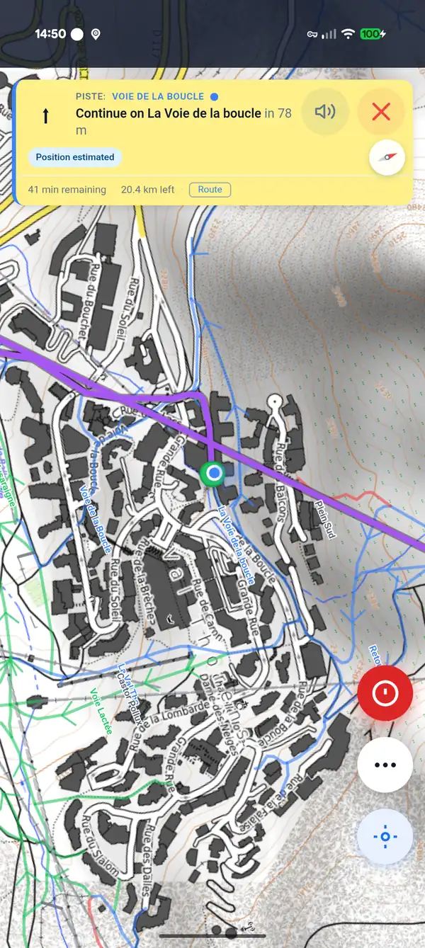
Turn-by-turn ski navigation in the Glidr app

Turn-by-turn guidance in the Glidr app. Illustrative — a different, longer route than the one above. Map tiles © OpenTopoMap (CC-BY-SA).
Get the whole mountain, one route at a time

Free to download on iOS and Android.

How this route was made — and what it is not

Data & attribution

Ski-area, piste and lift data on this page is derived from OpenStreetMap. © OpenStreetMap contributors, available under the Open Database License (ODbL).

Map data: © OpenStreetMap contributors, SRTM | Map style: © OpenTopoMap (CC-BY-SA)